mysite
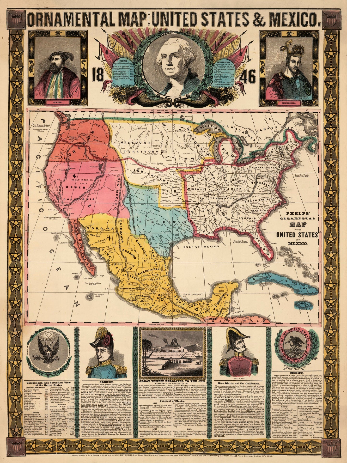
1847 Ornamental Map of the United States and Mexico
1847 Ornamental Map of the United States and Mexico
Share
Nie można załadować gotowości do odbioru
By: Humphrey Phelps
Date: 1847 (dated) New York
Original Size: 28.5 x 21 inches
This is a fine reproduction of one of the most sought after, decorative map of the United States and Mexico, published during the Mexican War.
This exciting work by Humphrey Phelps features the?new, enlarged state of Texas. The?Great Oregon Rail Road is delineated across the country, along crudely drawn state and territorial boundaries from New York to Oregon City. Territories depicted west of the Mississippi include the Missouri Territory, Indian Territory, the Oregon Territory and Upper California, which is shown under control of the United States before the was came to an end. Texas is shows as the largest it has ever been.
Adorning the map are portraits of Cortez, Washington, and Montezuma. Below the map are, portraits of generals Taylor and Santa Anna, the official seals of Mexico and America, as well as a view of an Aztec temple.The text describes the history of the region culminating with the Mexican American War and showing the United States in possession of New Mexico and the Californias despite the fact that the war had not yet ended at the time of publication.
Inventory #80006