mysite
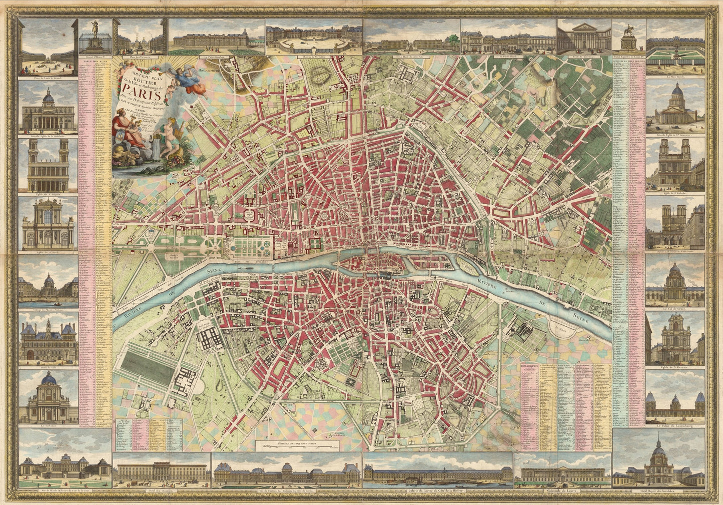
1784 Nouveau Plan Routier de la Ville et Faubourgs de Paris
1784 Nouveau Plan Routier de la Ville et Faubourgs de Paris
Cena regularna
€528,00 EUR
Cena regularna
€533,00 EUR
Cena promocyjna
€528,00 EUR
Z wliczonymi podatkami.
Koszt wysyłki obliczony przy realizacji zakupu.
Share
Ilość
Nie można załadować gotowości do odbioru
By: M. Pichon, Jacques Esnauts, Michel Rapilly
Original Date: 1784 (dated) Paris
Size of Original: 39 x 56 inches (99 x 142 cm)
This is a fine print reproduction of a spectacular, rare wall map of Paris depicts the city immediately prior to the French Revolution, with the Seine and Ile de la Cite as easily identifiable focal points at the center.
The map covers the city and its immediate environs.?Extensive tables identify streets, parishes, colleges, hospitals, major architectural edifices and other points of interest.?It is framed by a floral border with a title cartouche showing angels and an allegory of Paris, along with symbols of the arts and sciences. Around the map are 8 vignettes portraying landmarks and other places of importance.?
Inventory #81029