mysite
1740 Mappa Geographica, complectens I. Indiae Occidentalem II. Isthmum Panamensem...
1740 Mappa Geographica, complectens I. Indiae Occidentalem II. Isthmum Panamensem...
Cena regularna
€369,00 EUR
Cena regularna
€374,00 EUR
Cena promocyjna
€369,00 EUR
Z wliczonymi podatkami.
Koszt wysyłki obliczony przy realizacji zakupu.
Share
Ilość
Nie można załadować gotowości do odbioru
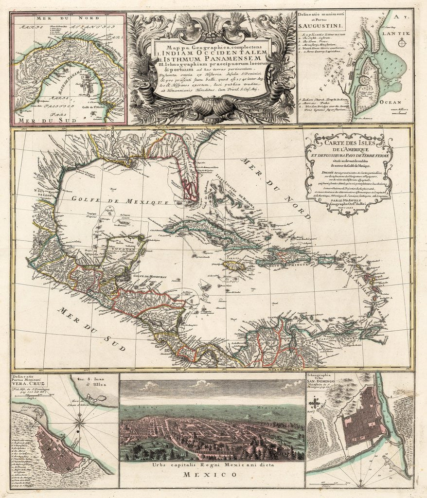
Mappa Geographica, complectens I. Indiae Occidentalem II. Isthmum Panamensem III. Ichnographiam praecipurorum locorum & portuum as has terras pertinentium
By: Homann Heirs
Date: 1740 (circa) Nuremberg
Original Size: 22.75 x 19 inches (57.8 x 48.5 cm)
This is a reproduction of an authentic antique map of the Caribbean with several smaller inserts surrounding, by Homann Heirs. The map was published in Nuremberg circa 1740.
This exciting?copper-plate engraving focuses on the Caribbean, showing portions of North, Central, and South America. The large central map is titled Carte de Isles de l¡¯Amerique et Deplusieurs Pays Terre Ferme,¡± and credits D¡¯Anville for the cartography. The map is color coded showing European possessions throughout the area. The main map is surrounded by 5 smaller insert maps that include the Isthmus of Panama, one of the earliest obtainable plans of St. Augustine, a bird¡¯s eye view of Mexico City, and plans of Vera Cruz and San Domingo.
Inventory #18910