mysite
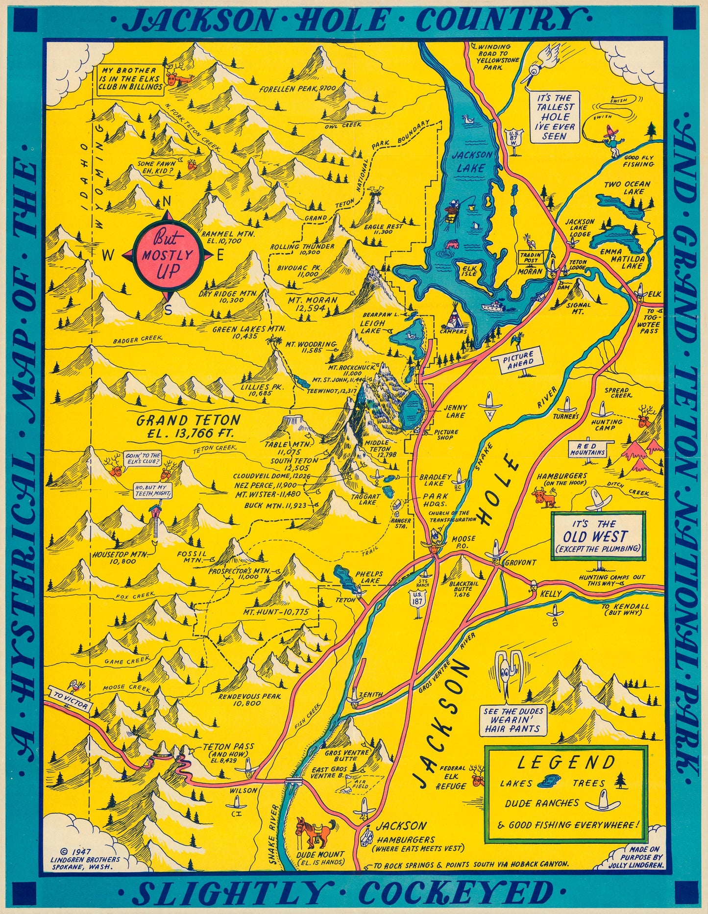
1947 A Hysterical Map of the Jackson Hole Country and Grand Teton National Park Slightly Cockeyed.
1947 A Hysterical Map of the Jackson Hole Country and Grand Teton National Park Slightly Cockeyed.
Share
Couldn't load pickup availability
By: The Lindgren Brothers
Date: 1947 (dated) Spokane, WA
Original Size: 22 x 17 inches
This is a fine print reproduction of a vintage pictorial map of?Jackson Hole and Grand Teton National Park that was originally produced by the Lindgren Brothers out of Spokane Washington in 1947. The map?presents all landmarks, points of interest and many other places through the use of imaginative illustrations and amusing commentary. The color palate and style in which the map was made makes it an inviting work that exemplifies the beauty and wonder of?Jackson Hole and the Grand Tetons.?????
Founded in 1928 by brother Jolly Elmer and? Oscar Simms Lindgren, the Lindgren Brothers?produced a series of whimsical pictorial maps, mostly focused on national parks, but also paid attention to other areas of great natural beauty and wonder. Their style and color scheme is easily recognizable once one becomes familiar with just a handful of their works. Their maps were wildly popular from the?mid-1930s to the 1950s as was tourism to the places their maps represent.? ?
Inventory #81056