mysite
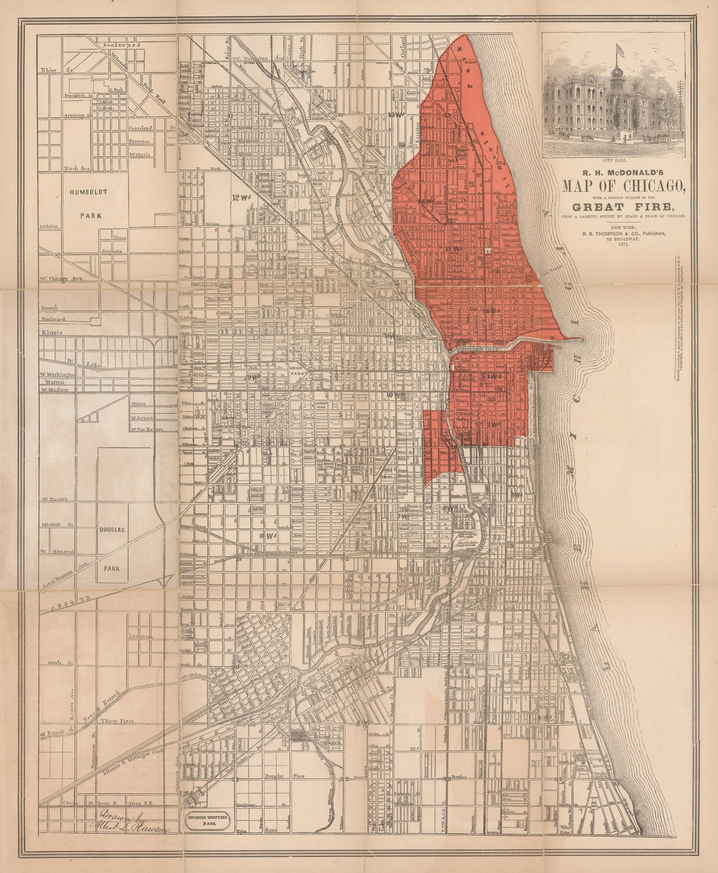
1871 R.H. McDonald¡¯s Map of Chicago with a correct outline of the Great Fire...
1871 R.H. McDonald¡¯s Map of Chicago with a correct outline of the Great Fire...
Share
Δεν ήταν δυνατή η φόρτωση της διαθεσιμότητας παραλαβής
By: R.H. McDonald
Date: 1871 (Published) New York
Original Size: 20 x 16.25 inches (50.8 cm x 41.3 cm)
This is a fine print reproduction of an important early pocket map of Chicago showing in red color the area destroyed by the Great fire of 1871, drawn by Albert L. Rawson.
The original map is scarce, and was created to show the world the destruction left in the path of the fire, which burned from October 8 to October 10, 1871, and destroyed thousands of buildings, killed an estimated 300 people and caused an estimated $200 million in damages. Legend has it that a cow kicked over a lantern in a barn and started the fire, but other theories hold that humans or even a meteor might have been responsible for the event that left an area of about four miles long and almost a mile wide of the Windy City, including its business district, in ruins.
Following the blaze, reconstruction efforts began quickly and spurred great economic development and population growth. According to the Chicago Public Library on-line catalogue the burnt district is incorrectly indicated.
Inventory #10771