1
/
από
1
mysite
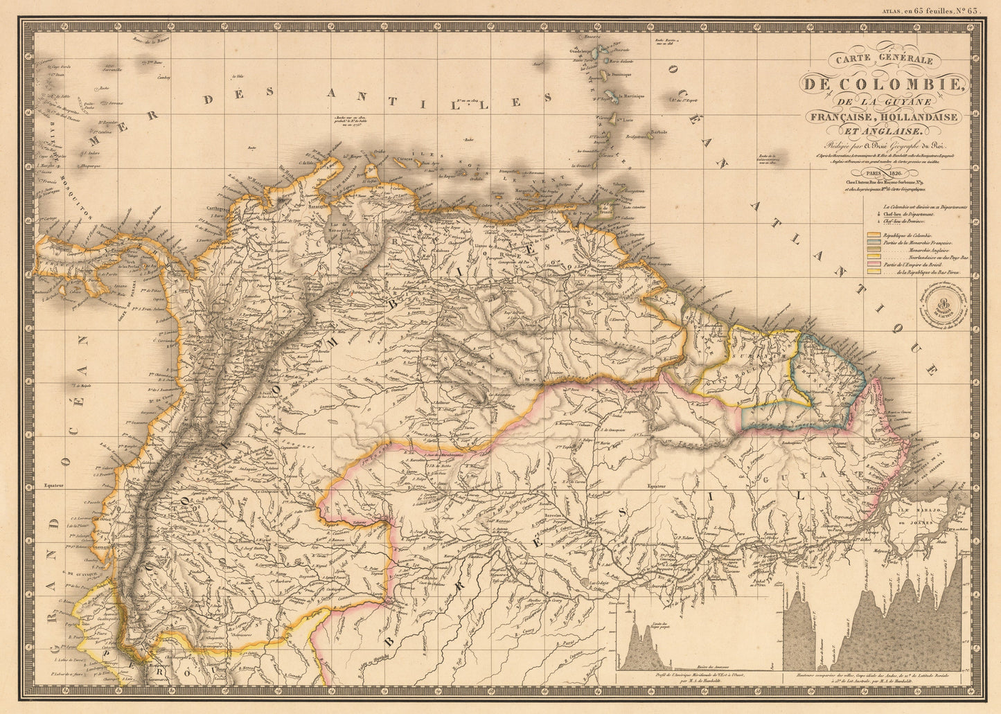
1826 Carte Generale De Colombie, et De La Guyane Francaise, Hollandaise, et Angliase.
1826 Carte Generale De Colombie, et De La Guyane Francaise, Hollandaise, et Angliase.
Κανονική τιμή
€369,00 EUR
Κανονική τιμή
€374,00 EUR
Τιμή έκπτωσης
€369,00 EUR
Οι φόροι συμπεριλαμβάνονται.
Τα έξοδα αποστολής υπολογίζονται κατά την ολοκλήρωση της αγοράς.
Share
Ποσότητα
Δεν ήταν δυνατή η φόρτωση της διαθεσιμότητας παραλαβής
By: Adrien Hubert Brue
Date: 1826 (Published) Paris
Original Size: 14.25 x 20.25 inches (36.2 x 51.4 cm)
This is a fine print reproduction of Brue's map of Colombia from the early 19th Century. Brue¡¯s large map is highly detailed in every aspect, showing the wealth of knowledge which had been gleaned over the centuries since Europeans first set foot in South America.
This map includes a short stretch of Central America, and the Antilles Islands. Geographical features including mountains, rivers, including the magnificent Amazon drainage system - largest in the world, its estuaries, streams, etc., are all depicted in great detail. The Andes are beautifully rendered and in the lower right quadrant of the map Brue has included profiles comparing the various heights of specific areas in the great mountain chain, based on the findings of M.A. de Humboldt, the famed Prussian geographer, naturalist and explorer.
Inventory #10995