mysite
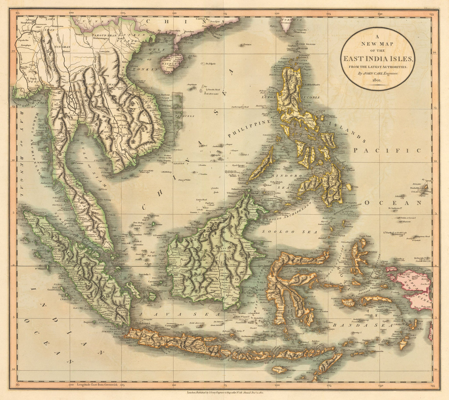
1801 A New Map of the East India Isles
1801 A New Map of the East India Isles
Share
Δεν ήταν δυνατή η φόρτωση της διαθεσιμότητας παραλαβής
By: John Cary
Date: 1801 (dated) London
Original Size: 18 x 20.5 inches (45.7 cm x 52 cm)
This is a reproduction of an antique map that is a masterpiece by the prominent mapmaker John Cary. It depicts all of Southeast Asia and the Malay peninsula, including the Philippines, Borneo, Java and parts of Papua New Guinea. It is one of the few maps of the area to include the volcanic island of Krakatoa, which was to erupt with such explosive force in 1883 that the island itself disappeared. Cary's map also includes the Straits of Singapore, and it wonderfully depicts the mountain ranges of the entire region. Shoals, reefs and shallows along all shorelines are clearly delineated.
Inventory #19165