1
/
από
1
mysite
1719 Carte Particuliere Du Fleuve Saint Louis...
1719 Carte Particuliere Du Fleuve Saint Louis...
Κανονική τιμή
€369,00 EUR
Κανονική τιμή
€374,00 EUR
Τιμή έκπτωσης
€369,00 EUR
Οι φόροι συμπεριλαμβάνονται.
Τα έξοδα αποστολής υπολογίζονται κατά την ολοκλήρωση της αγοράς.
Share
Ποσότητα
Δεν ήταν δυνατή η φόρτωση της διαθεσιμότητας παραλαβής
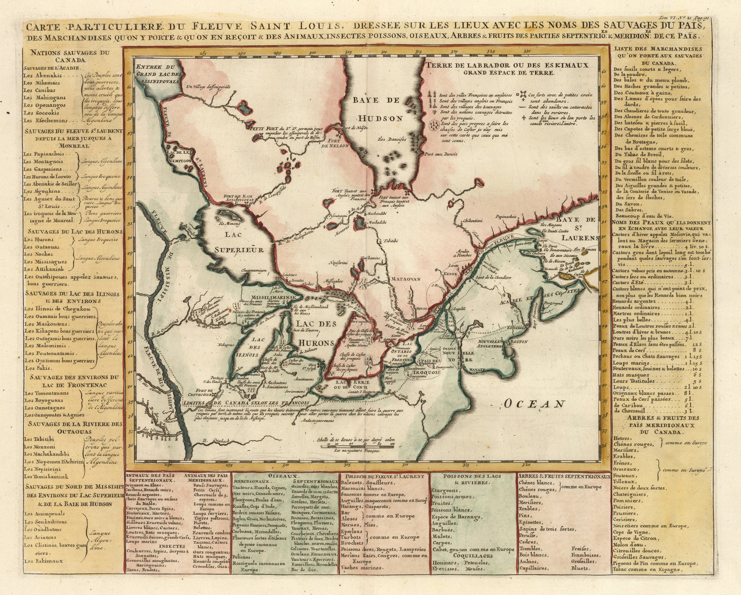
Carte Particuliere Du Fleuve Saint Louis Dressee Sur Les Lieux Avec Les Noms Des Sauvages Du Pais,Des Marchandises Qy¡¯on En Recoit & Des Animaux...
By:?Henri Abraham Chatelain
Date:?1719 (Published) Amsterdam
Dimensions:?14.25 x 18 inches (36.2 cm x 45.7 cm)
This is a fine print reproduction of an important, intriguing, and uniquely informative map by Henri Abraham Chatelain. It depicts Canada, the Great Lakes, and the path of the Mississippi River and constitutes a remarkable compendium of the best and most recent compilations of its day.
Depicting the locations and territories of various French Missions and Forts, of French and Indian settlements, significant river crossing locations, portages, the map provided essential?information?to explorers, trappers, to all who had travelled to the New World to reap the bounty afforded by it, particularly the fur-trading industry.
Another salient aspect of Chatelain¡¯s map is the information bordering the cartographic image. With great care Chatelain names and places indigenous peoples of the various regions including those of Canada, the St. Lawrence River, those near Lake Huron, etc., notes the languages spoken by them and their tribal affiliations.
Chatelain?enumerates the wide variety of goods available and animals (wild game) to be found, the flora and fauna of this bountiful region are well described. Furthermore, furs and their trade value with different items are catalogued giving the viewer an appreciation of the socio-economic context in which early exploration took place.
Inventory #11016